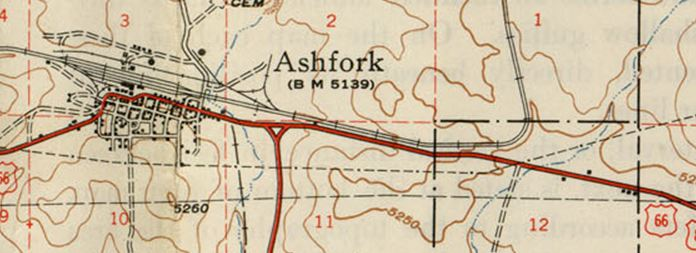
I have located a couple of lost road segments. Finding a 1949 USGS Topo map started it. I was looking for some information to help locate a Whiting Brothers gas station East of Ash Fork that was torn down. As I looked at the map and then an aerial view I thought how nice it would be to overlay them in the same scale. So I captured the two images and imported them into Paint Dot Net in separate layers. That way I could scale the map and move it to perfectly align it over the image. First I adjusted contrast to white out the background and then made the background transparent so only the roads and railroad tracks were left and the aerial view could be seen behind them.
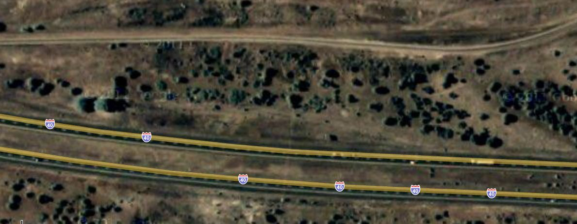
Once I got them aligned I noticed something. There was a place that Rt 66 went just North of where I-40 is now. I had always thought it was under I-40 all the way to the East. This got me to checking closer so I zoomed in on Google Maps and looked at that spot. There is was, right where the map showed it should be, an old road bed between the tracks and the Interstate with the right arch and angle. I checked my books and on-line references and could not find any mention of this little segment. To me this was every bit as exciting as panning for gold and finding a nice nugget. (just not as profitable)
In June of 2011 we made a quick run to Ash Fork to have a look at this location. It was really exciting. We pulled off Interstate 40 as far as possible and walked up a slight hill to find an original stretch of asphalt topping the hill and angling down towards the access road on the opposite side that used to be 66. So this myth is CONFIRMED. A small piece of lost 66 rediscovered!

Tucumcari Nugget
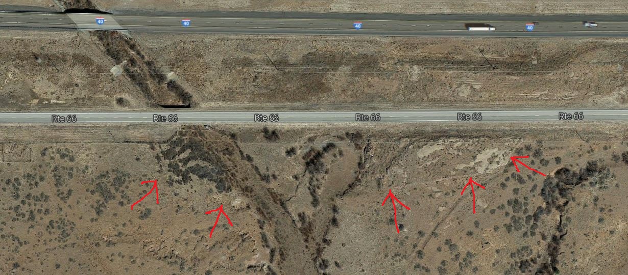
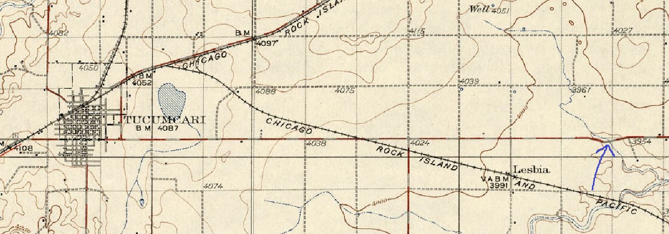
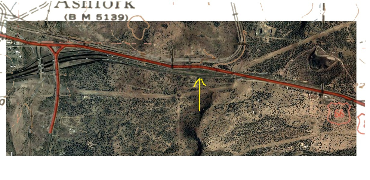
This lost road segment is a little less complicated to find and comes from a 1930 USGS Topo map. 10 miles East of the center of Tucumcari the USGS map shows RT 66 taking a small dip to the South right at a river. I had a look with an aerial view and there are a faint remnants of a road at the place and angle shown in the map. The images are pretty self explanatory. It looks like there should be some sign of a crossing at that point. We stopped here on a trip and there appears to be cuts made for a roadway. They are mostly visible at the east end. There were no signs of construction at the creek so maybe it was a temporary low water crossing? Get online historical maps and see if you can find some lost road segments.